FIRST ALERT WEATHER: Mild Tuesday before temperatures drop again
A cold front will arrive Wednesday
After a crisp start to Monday morning in the 30s, the Ozarks enjoyed a pleasant afternoon with temperatures climbing into the lower to middle 70s under sunny skies. But don’t get too comfortable — a cold front is on its way.
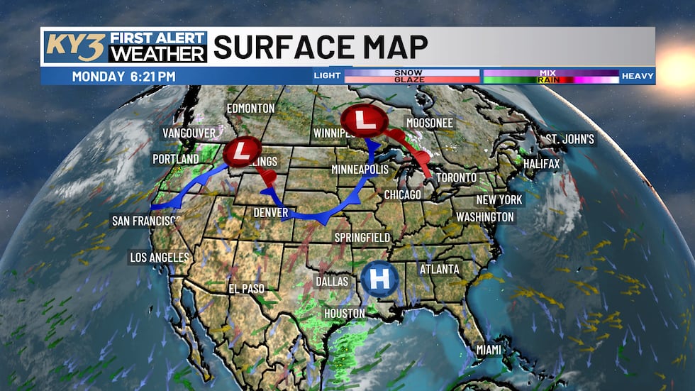
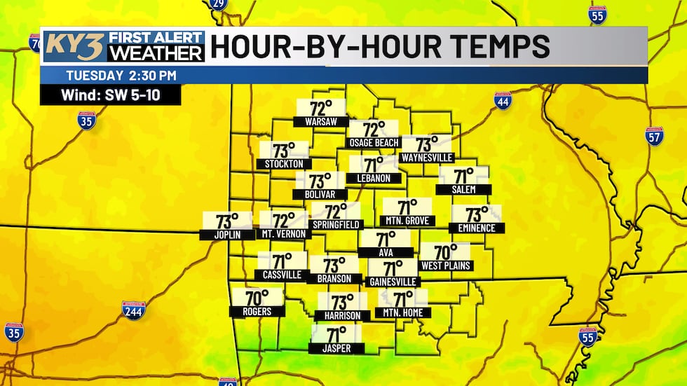
Tuesday will be the last hurrah of mild weather for several days. High pressure sitting off to the southeast will keep skies quiet and sunny throughout the day. Most areas will start in the lower to middle 40s, with a few low-lying spots possibly dipping into the 30s overnight. Highs Tuesday afternoon will reach the lower 70s, making it another pleasant day to get outside.
Wednesday brings the cold front and cooling trend
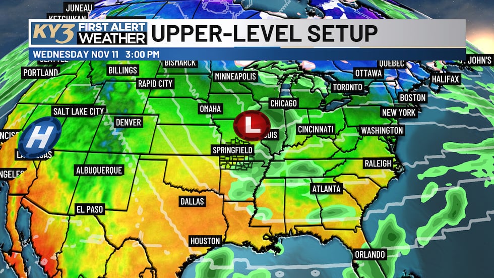
The cold front arrives Wednesday, ushering in noticeably cooler air and cloudier skies. While most of the Ozarks will stay dry, the Missouri Bootheel and Ohio River Valley have a better chance for rain and isolated thunderstorms. A few lucky spots in the eastern and southeastern Ozarks could see an isolated shower or storm, but overall, expect dry conditions across the region.
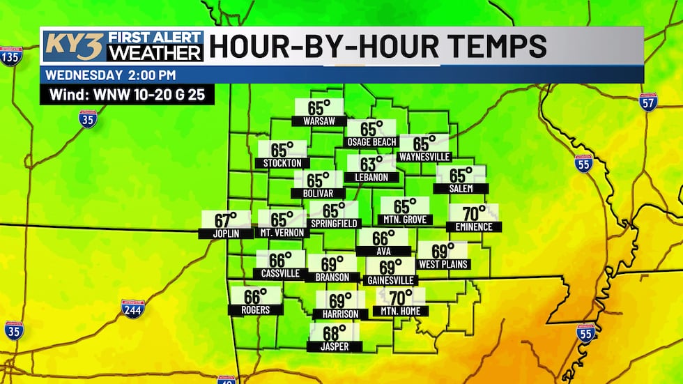
Wednesday morning will start chilly in the 50s, with highs only reaching the middle to upper 60s — a significant drop from Tuesday’s warmth.
The coldest morning of the season arrives Saturday
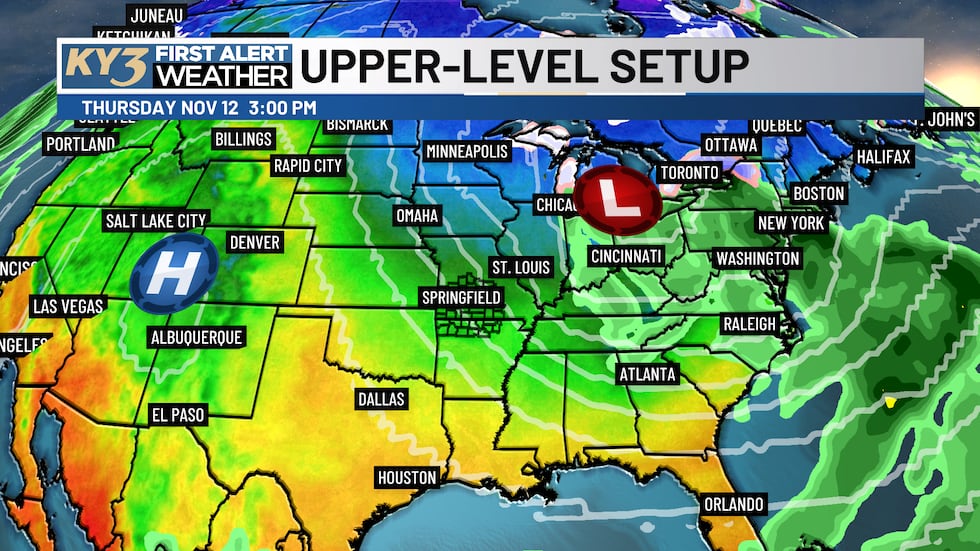
Behind the departing front, an upper-level low will intensify the cooling trend Thursday and Friday. Thursday morning lows will drop to the lower 40s with highs in the middle 50s. Friday will be even colder, starting in the low 30s with highs only in the upper 40s.
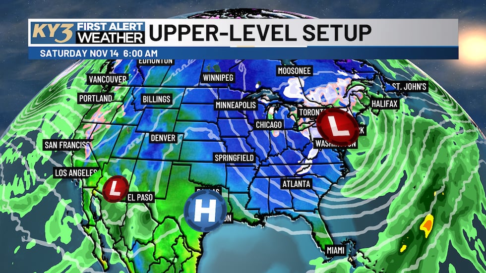
The coldest morning of the season so far arrives Saturday — the opening day of Deer Season. Expect lows in the upper 20s across the Ozarks, so bundle up if you’re heading out to the woods. Highs Saturday will rebound to the lower to middle 50s under quiet skies.
Next chance for rain arrives Sunday
An upper-level wave may move into the region Sunday afternoon and clear out Monday, bringing the best chance for isolated to scattered showers over the next seven days.
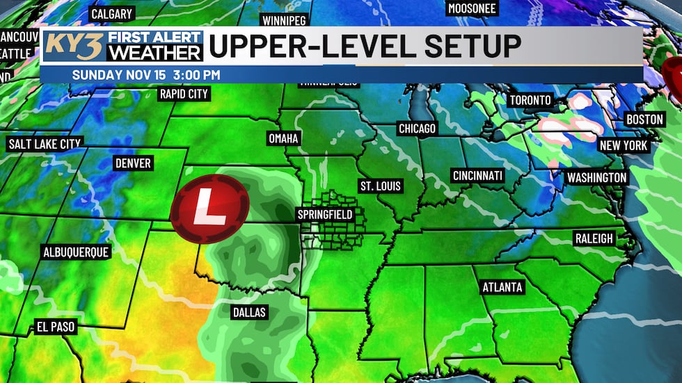
Sunday and Monday will feature lows in the upper 30s and lower 40s with highs in the middle 50s.
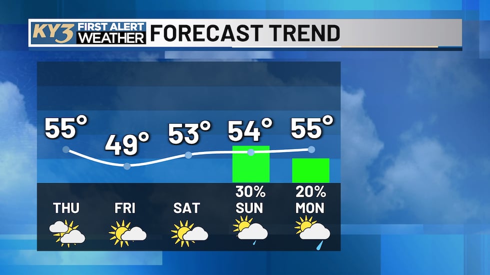
First Alert Weather Forecast at a Glance:
- Tonight: Quiet skies, lows in the 30s-40s
- Tuesday: Sunny and mild, highs in the lower 70s
- Wednesday: Partly to mostly cloudy, highs in the middle-upper 60s, isolated showers possible
- Thursday-Saturday: Dry, cooling trend, coldest morning Saturday in the upper 20s
- Sunday-Monday: Isolated to scattered showers possible, highs in the middle 50s
Copyright 2026 KY3. All rights reserved.