FIRST ALERT WEATHER: Cold start to Sunday before a milder afternoon
Up & down temperatures lining up next week
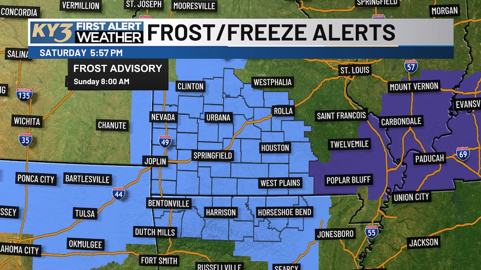
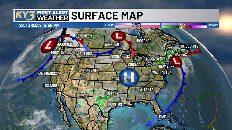
A frost advisory is in effect until 8 a.m. Sunday as high pressure settles over the Ozarks, bringing mostly clear skies and cold overnight temperatures that could dip into the 30s across the region.
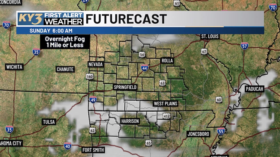
The combination of clear skies and dew point temperatures could create areas of patchy fog overnight, with some spots potentially experiencing visibility down to a mile or less. Be prepared for slower travel conditions early Sunday morning if fog develops, though it should clear quickly after sunrise.
Sunday & Monday: Cold start with milder afternoons
Sunday will begin cold with lows around 35° in Springfield, with lower to middle 30s east of US Highway 65 and middle to upper 30s west of the highway.
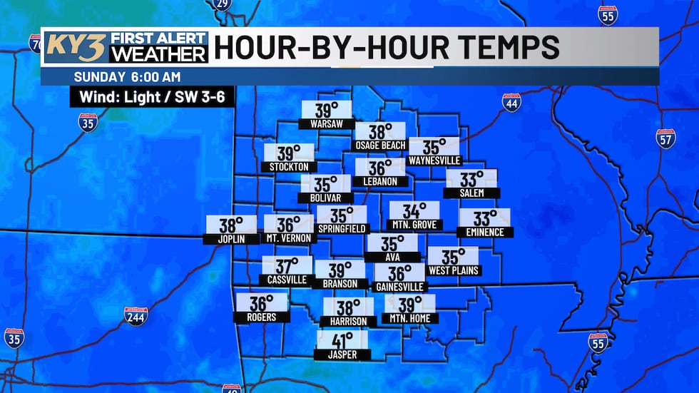
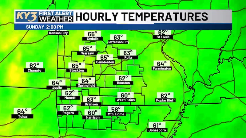
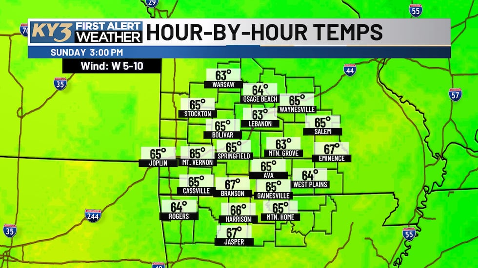
However, temperatures will rebound nicely throughout the day, climbing into the lower 60s by noon and reaching the middle 60s by afternoon.
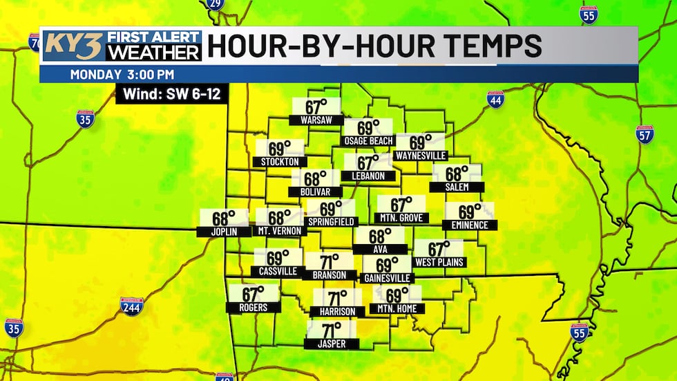
Another round of patchy fog is possible Monday morning, but conditions will remain mostly sunny. After morning lows in the upper 30s and lower 40s, highs will climb into the upper 60s to lower 70s.
Warming Trend Continues Through Tuesday
Tuesday looks pleasant with mostly to partly sunny skies and highs in the lower 70s. Morning lows will settle in the middle 40s.
Storm System Arrives Late Tuesday Into Wednesday
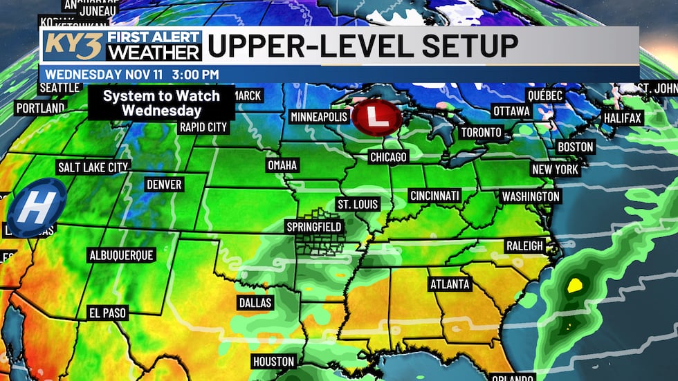
A storm system will move into the area late Tuesday night and Wednesday, bringing possible rain chances and a few rumbles of thunder. The system appears to be on the drier side, but scattered showers and isolated thunderstorms are possible at times Wednesday. Any showers should wrap up Wednesday night.
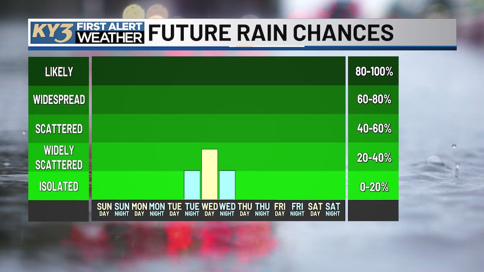
Cooling Trend Thursday & Into Next Weekend
After the system moves out, expect dry conditions from Thursday through next weekend. However, a noticeable cooling trend will take hold Thursday through Saturday as an upper-level dip in the jet stream moves across the eastern United States.
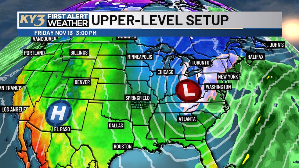
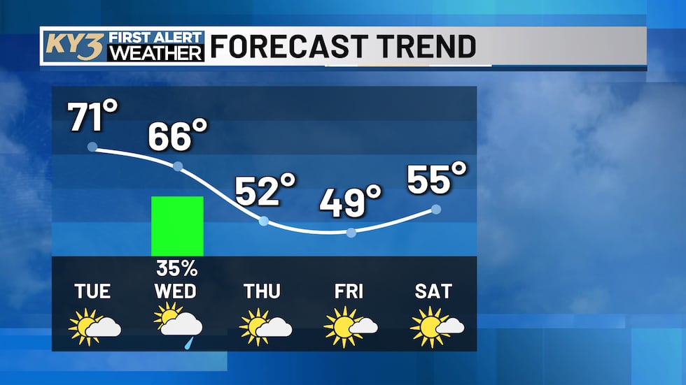
Temperatures will drop noticeably, with highs in the middle 60s Wednesday, Thursday in the lower 50s and Friday in the upper 40s. Friday and Saturday mornings will see lows near freezing. Conditions should gradually warm back up late next weekend as milder air returns. Conditions should gradually warm back up late next weekend as milder air returns with highs back in the middle 50s on Saturday.
Copyright 2026 KY3. All rights reserved.