FIRST ALERT WEATHER: Quiet & very mild Monday lined up
Looking at rain chances closer to Halloween
The pleasant pattern that brought mild conditions to the Ozarks on Sunday continues into the week, but rain is already on the radar for Halloween weekend.
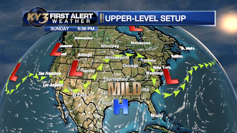
An upper-level ridge of high pressure centered over the Gulf Coast will stretch across the region through Monday, keeping skies mostly cloudy overnight and into Monday morning.
Expect lows in the lower to middle 50s, with a few low-lying spots dipping into the 40s. Afternoon highs will reach the middle 70s with partly to mostly sunny skies returning by afternoon.
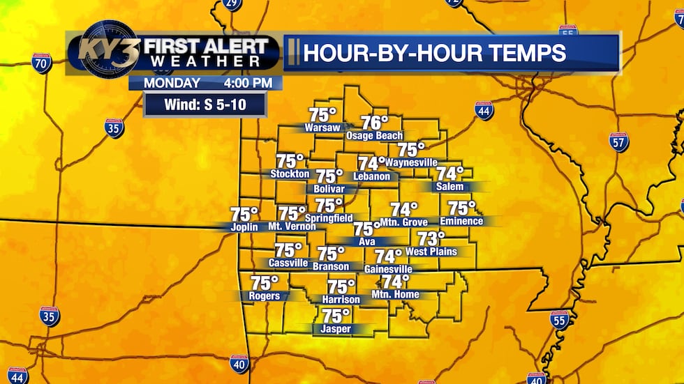
The mild stretch continues as the ridge holds strong over the region through mid-week.
Stray Showers Possible Tuesday
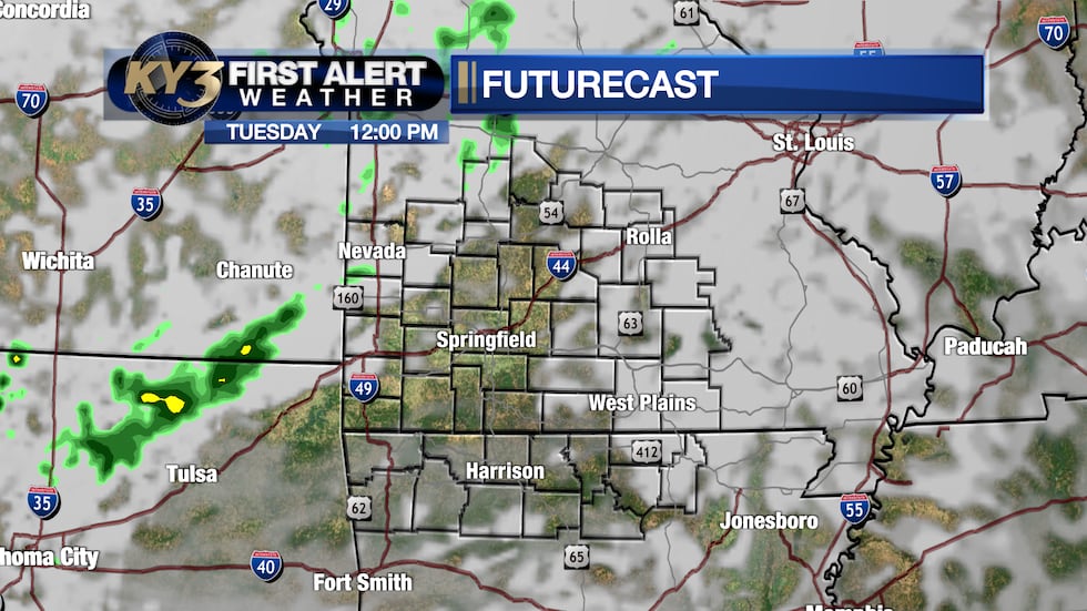
The first sign of change arrives Tuesday as an upper-level wave moves in from Denver. Mostly cloudy skies will dominate the day, and a stray shower or sprinkle is possible late Tuesday afternoon through very early Wednesday morning.
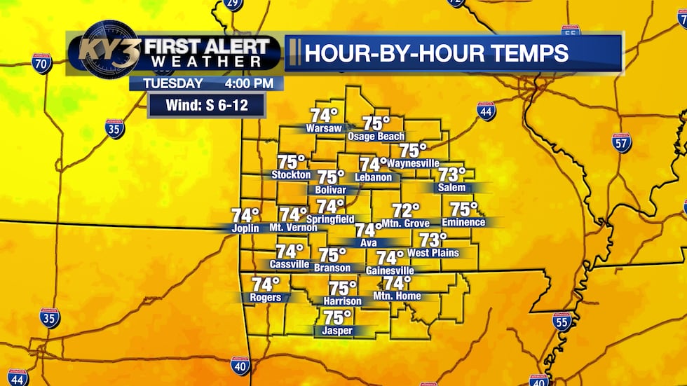
Temperatures will remain mild, with lows in the middle 50s and highs in the middle 70s.
After any early Wednesday morning sprinkles clear out, expect partly to mostly sunny skies for the rest of the day—a nice break before the next system arrives.
Halloween Rain on the Horizon
The focus shifts to late week as moisture increases and rain chances climb.
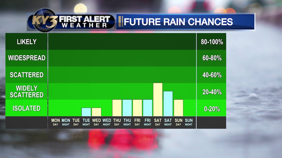
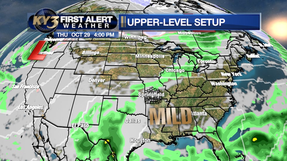
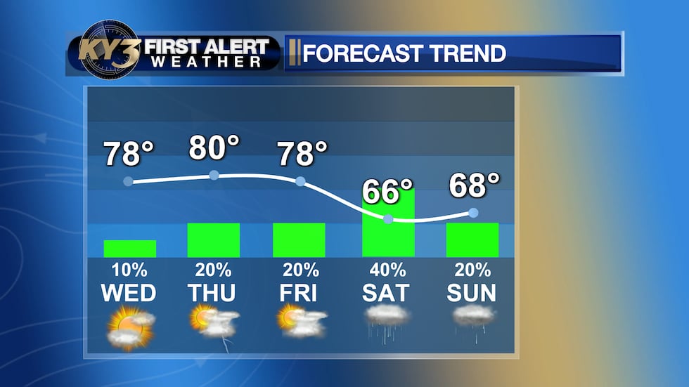
A weak impulse Thursday and Friday could bring a few isolated showers and rumbles of thunder, but most spots should stay dry. Temperatures will be pleasant, with lows in the middle to upper 50s and highs in the upper 70s to around 80°.
However, a stronger system is expected to move in for Halloween weekend. Scattered showers are forecast for Saturday and Halloween night, with off-and-on rain possible throughout the day. A few isolated showers could linger into Sunday morning.
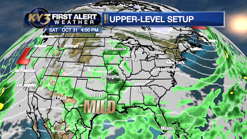
If clouds and rain lock in as expected for Halloween, temperatures will be cooler—lows in the upper 50s and afternoon highs only reaching the middle 60s. Halloween night will turn chilly, with temperatures dropping into the middle 50s by Sunday morning.
Stay Updated
The timing of late-week rain is still subject to change, so check back throughout the week for updates. Keep it locked to First Alert Weather for the latest forecast details.
Copyright 2026 KY3. All rights reserved.